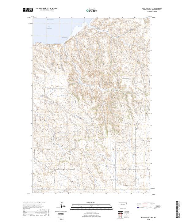
2024 Map of Watford City NW
USGS Topo · Published 2024About this map
The Missouri River and the expansive waters of Lake Sakakawea define the northern edge of this McKenzie County landscape. This modern survey illustrates the rugged drainage patterns of the Missouri Plateau, where numerous coulees and ridges descend toward the water. Significant inlets like Wild Cow Bay break the shoreline, while further south, Tobacco Garden Creek winds through the interior. The map documents the grid-based road network of the contemporary rural West, including county routes such as Co Rd 29 and Co Rd 31, along with local arteries like A Rt 18. This area remains predominantly defined by its natural topography and the influence of the dammed river system, which transformed the historical river valley into a massive reservoir, altering the local geography from its original frontier-era state.
Find a feature on this map
19 named features on this map. Tap any name to fly to it.
Don’t see what you’re looking for? This feature index may not catch every label — zoom into the map to look around manually.
Map Details
Editions of this 2024 Watford City NW Map
This is the sole edition of this map. No revisions or reprints were ever made.
Other maps of this area

1911 · Ray
USGS Topo · 1:125,000

1953 · Williston
USGS Topo · 1:250,000

1953 · Watford City
USGS Topo · 1:250,000

1957 · Williston
USGS Topo · 1:250,000

1957 · Watford City
USGS Topo · 1:250,000

1967 · Watford City
USGS Topo · 1:250,000

1972 · Rawson
USGS Topo · 1:24,000

1978 · Lake Jessie
USGS Topo · 1:24,000

1978 · Watford City NW
USGS Topo · 1:24,000

1978 · Arnegard
USGS Topo · 1:24,000