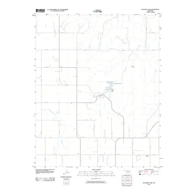
2010 Map of Watonga Lake
USGS Topo · Published 2010About this map
Watonga Lake and Boecher Lake form a central hydrological focus in this western Oklahoma landscape, which is characterized by a high-density grid of county roads and the winding course of the North Canadian River. This river corridor in the southwestern portion of the map contrasts with the northern uplands, where drainage is defined by the ephemeral flow of Bitter Creek and the deep incision of Cat Canyon. The presence of Big Spring near the lakes suggests the importance of natural water sources in this region's development.
Find a feature on this map
25 named features on this map. Tap any name to fly to it.
Don’t see what you’re looking for? This feature index may not catch every label — zoom into the map to look around manually.
Map Details
Editions of this 2010 Watonga Lake Map
This is the sole edition of this map. No revisions or reprints were ever made.
Other maps of this area

1955 · Clinton
USGS Topo · 1:250,000

1955 · Woodward
USGS Topo · 1:250,000

1957 · Clinton
USGS Topo · 1:250,000

1958 · Woodward
USGS Topo · 1:250,000

1964 · Oakwood
USGS Topo · 1:62,500

1972 · Watonga
USGS Topo · 1:24,000

1972 · Canton
USGS Topo · 1:24,000

1972 · Watonga SE
USGS Topo · 1:24,000

1972 · Southard
USGS Topo · 1:24,000

1972 · Okeene
USGS Topo · 1:24,000