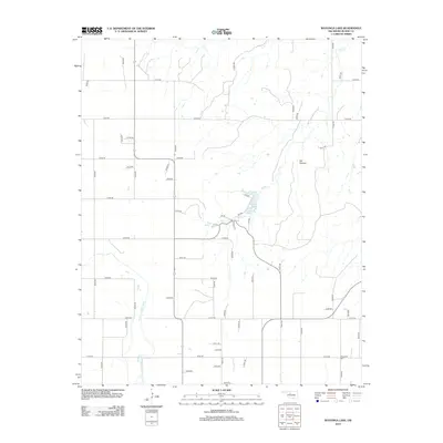
2012 Map of Watonga Lake
USGS Topo · Published 2012About this map
North Canadian River flows through the southwestern corner of this Blaine County landscape, defining the hydrology of a region marked by high plains and seasonal drainages. Centrally located, Watonga Lake and Boecher Lake provide significant water storage, fed by the winding course of Bitter Cr. The terrain is punctuated by distinctive landforms such as Cat Canyon to the northeast and the localized water source at Big Spring. A strictly organized grid of rural section roads, including n2550 RD and e0730 RD, facilitates access across the plains, reflecting the systematic land division of Oklahoma. For those tracing local history, the Bridgeford Cem stands as a primary genealogical landmark near the southeastern corner, while the network of park roads like p60 RD and p20 RD around the lakes suggests a focal point for regional recreation.
Find a feature on this map
55 named features on this map. Tap any name to fly to it.
Don’t see what you’re looking for? This feature index may not catch every label — zoom into the map to look around manually.
Map Details
Editions of this 2012 Watonga Lake Map
This is the sole edition of this map. No revisions or reprints were ever made.
Other maps of this area

1955 · Clinton
USGS Topo · 1:250,000

1955 · Woodward
USGS Topo · 1:250,000

1957 · Clinton
USGS Topo · 1:250,000

1958 · Woodward
USGS Topo · 1:250,000

1964 · Oakwood
USGS Topo · 1:62,500

1972 · Watonga
USGS Topo · 1:24,000

1972 · Canton
USGS Topo · 1:24,000

1972 · Watonga SE
USGS Topo · 1:24,000

1972 · Southard
USGS Topo · 1:24,000

1972 · Okeene
USGS Topo · 1:24,000