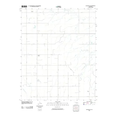
2009 Map of Watonga SE
USGS Topo · Published 2009About this map
Evergreen Cemetery sits in the northern reaches of this rural landscape, marking a history of early settlement in Blaine County. The terrain is defined by a grid of section roads, including e0800 RD and n2610 RD, which traverse the open plains and intermittent drainages. Waterways like Kingfisher Creek and the North Canadian River provide the primary natural breaks in the geometric agricultural pattern. For genealogists and local historians, the presence of several established burial grounds, such as East Mount Pleasant Cemetery and Udora Cemetery, offers concrete links to the families who established farms and homesteads in this Oklahoma corridor during the twentieth century. The map illustrates a region where land use remains deeply tied to the natural watercourses and the established township-and-range surveying system.
Find a feature on this map
22 named features on this map. Tap any name to fly to it.
Don’t see what you’re looking for? This feature index may not catch every label — zoom into the map to look around manually.
Map Details
Editions of this 2009 Watonga SE Map
This is the sole edition of this map. No revisions or reprints were ever made.
Other maps of this area

1893 · Fort Reno
USGS Topo · 1:62,500

1893 · Loyal
USGS Topo · 1:62,500

1941 · Fort Reno
USGS Topo · 1:62,500

1942 · Fort Reno
USGS Topo · 1:62,500

1942 · Geary
USGS Topo · 1:62,500

1949 · Fort Reno
USGS Topo · 1:62,500

1955 · Clinton
USGS Topo · 1:250,000

1957 · Clinton
USGS Topo · 1:250,000

1972 · Watonga
USGS Topo · 1:24,000
1972 · Omega
USGS Topo · 1:24,000