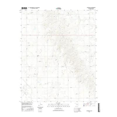
2016 Map of Watonga SE
USGS Topo · Published 2016About this map
Evergreen Cem and East Mount Pleasant Cem anchor this section of Oklahoma’s rural landscape, where the terrain transitions from the headwaters of Kingfisher Cr to the southwest toward the N Canadian River. The area is defined by a dense grid of section-line roads, including e0790 RD and n2610 RD, which trace the systematic agricultural settlement of Blaine County. This 2016 survey illustrates the persistent rural character of the region, where family history is preserved in isolated burial grounds like Udora Cem. The topographic detail reveals the subtle drainages and elevation changes between the river valley and the northern creeks, mapping a quiet territory of farmsteads and open range defined more by its geography and road network than by centralized townships.
Find a feature on this map
31 named features on this map. Tap any name to fly to it.
Don’t see what you’re looking for? This feature index may not catch every label — zoom into the map to look around manually.
Map Details
Editions of this 2016 Watonga SE Map
This is the sole edition of this map. No revisions or reprints were ever made.
Other maps of this area

1893 · Fort Reno
USGS Topo · 1:62,500

1893 · Loyal
USGS Topo · 1:62,500

1941 · Fort Reno
USGS Topo · 1:62,500

1942 · Fort Reno
USGS Topo · 1:62,500

1942 · Geary
USGS Topo · 1:62,500

1949 · Fort Reno
USGS Topo · 1:62,500

1955 · Clinton
USGS Topo · 1:250,000

1957 · Clinton
USGS Topo · 1:250,000

1972 · Watonga
USGS Topo · 1:24,000
1972 · Omega
USGS Topo · 1:24,000