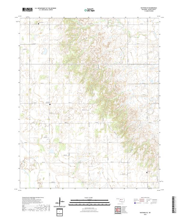
2022 Map of Watonga SE
USGS Topo · Published 2022About this map
Kingfisher Cr meanders across the northern sections of this Blaine County landscape, where the terrain transitions from open creek bottoms to the distinct elevation of Porcupine Butte. This rural expanse is defined by its grid-patterned infrastructure, with secondary routes like e0830 RD and n2600 RD connecting isolated homesteads and local landmarks. The area's heritage is preserved in several small burial grounds, including East Mount Pleasant Cem and Evergreen Cem, which serve as primary markers for family historians in this sparsely settled region. To the south, the N Canadian River cuts through the southwestern corner, further shaping the drainage and topography of these Oklahoma plains. The map meticulously records the intersection of Section 16 school lands and township boundaries such as t16n r11w, illustrating the enduring influence of the Public Land Survey System on the modern landscape.
Find a feature on this map
35 named features on this map. Tap any name to fly to it.
Don’t see what you’re looking for? This feature index may not catch every label — zoom into the map to look around manually.
Map Details
Editions of this 2022 Watonga SE Map
This is the sole edition of this map. No revisions or reprints were ever made.
Other maps of this area

1893 · Fort Reno
USGS Topo · 1:62,500

1893 · Loyal
USGS Topo · 1:62,500

1941 · Fort Reno
USGS Topo · 1:62,500

1942 · Fort Reno
USGS Topo · 1:62,500

1942 · Geary
USGS Topo · 1:62,500

1949 · Fort Reno
USGS Topo · 1:62,500

1955 · Clinton
USGS Topo · 1:250,000

1957 · Clinton
USGS Topo · 1:250,000

1972 · Watonga
USGS Topo · 1:24,000
1972 · Omega
USGS Topo · 1:24,000