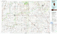
1990 Map of Watseka
USGS Topo · Published 1991About this map
The Iroquois River and its major tributaries, Sugar Creek and Beaver Creek, dictate the geography of this borderland region between Illinois and Indiana. By the early 1990s, the landscape was defined by its intensive drainage network, including the Bice Ditch and Carpenter Creek, alongside sprawling conservation lands like the Iroquois County State Conservation Area. The settlement pattern reflects the area's agricultural and transportation history, with towns such as Watseka, Gilman, and Kentland serving as hubs for the surrounding prairie townships.
Find a feature on this map
111 named features on this map. Tap any name to fly to it.
Don’t see what you’re looking for? This feature index may not catch every label — zoom into the map to look around manually.
Map Details
Editions of this 1990 Watseka Map
This is the sole edition of this map. No revisions or reprints were ever made.
Other maps of this area

1922 · Momence
USGS Topo · 1:62,500

1922 · Kankakee
USGS Topo · 1:62,500

1923 · Herscher
USGS Topo · 1:62,500

1924 · Momence
USGS Topo · 1:62,500

1924 · Kankakee
USGS Topo · 1:62,500

1924 · Paxton
USGS Topo · 1:62,500

1925 · Herscher
USGS Topo · 1:62,500

1927 · Paxton
USGS Topo · 1:62,500

1933 · Hoopeston
USGS Topo · 1:48,000

1935 · Watseka
USGS Topo · 1:48,000