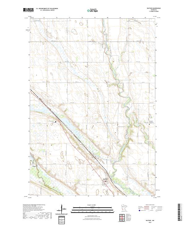
2022 Map of Watson
USGS Topo · Published 2022About this map
Watson and Churchill anchor this southwestern Minnesota landscape, situated at the confluence of several significant waterways and geographic formations. The map highlights the Chippewa River as it winds toward its meeting with the Minnesota River, framed by the prominent Higland Ridge. A unique geological feature, the Watson Sag, cuts through the center of the terrain, illustrating the glacial history that shaped this river valley.
Find a feature on this map
29 named features on this map. Tap any name to fly to it.
Don’t see what you’re looking for? This feature index may not catch every label — zoom into the map to look around manually.
Map Details
Editions of this 2022 Watson Map
This is the sole edition of this map. No revisions or reprints were ever made.
Other maps of this area

1953 · New Ulm
USGS Topo · 1:250,000

1953 · Saint Cloud
USGS Topo · 1:250,000

1957 · Saint Cloud
USGS Topo · 1:250,000

1957 · New Ulm
USGS Topo · 1:250,000

1958 · New Ulm
USGS Topo · 1:250,000

1958 · Saint Cloud
USGS Topo · 1:250,000

1958 · Milan
USGS Topo · 1:24,000

1958 · Big Bend City
USGS Topo · 1:24,000

1958 · Watson
USGS Topo · 1:24,000

1958 · Milan NW
USGS Topo · 1:24,000