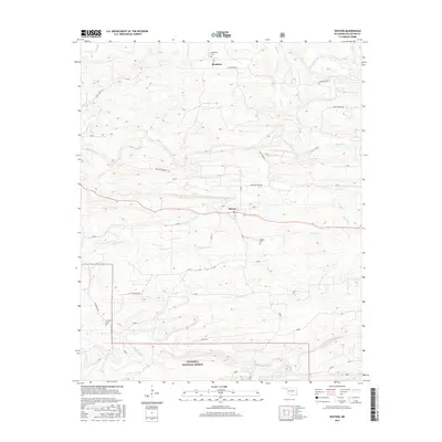
2016 Map of Watson
USGS Topo · Published 2016About this map
Watson and Beachton serve as the primary hubs in this corner of McCurtain County, where the southern reaches of the Ouachita National Forest define the landscape. The area's drainage is complex, characterized by the winding Mountain Fork and numerous tributaries such as Roosevelt Cr and Mud Lick Cr. The survey details a network of rural roads that trace the undulating topography, including Goat Rock Rd and Welcome Home Rd, connecting isolated homesteads to the settlements. For those researching local family history, the map provides precise locations for Beechtree Cem, Watson Cem, and Buffalo Cem, which are often the most enduring markers of early communities in this timber-rich region. The presence of Mine Cr in the southeast suggests a history of resource extraction, while the concentration of settlements near the central road corridors highlights the importance of these thoroughfares to the local economy.
Find a feature on this map
25 named features on this map. Tap any name to fly to it.
Don’t see what you’re looking for? This feature index may not catch every label — zoom into the map to look around manually.
Map Details
Editions of this 2016 Watson Map
This is the sole edition of this map. No revisions or reprints were ever made.
Other maps of this area

1890 · Poteau Mountain
USGS Topo · 1:125,000

1899 · Poteau Mountain
USGS Topo · 1:125,000

1900 · Winding Stair
USGS Topo · 1:125,000

1902 · Lukfata
USGS Topo · 1:125,000

1909 · Winding Stair
USGS Topo · 1:125,000

1913 · De Queen
USGS Topo · 1:125,000

1950 · Mcalester
USGS Topo · 1:250,000

1958 · Potter
USGS Topo · 1:62,500

1958 · Zafra
USGS Topo · 1:24,000

1959 · Page
USGS Topo · 1:62,500