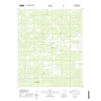
2018 Map of Watson
USGS Topo · Published 2018About this map
Watson and Beachton serve as the primary hubs in this corner of McCurtain County, where the landscape is defined by the winding course of the Mountain Fork river. This 2018 survey reveals a rural network of roads such as Welcome Home Rd and Goat Rock Rd that weave through the northern reaches of the Ouachita National Forest. The map is particularly useful for genealogical research, documenting several small burial grounds including Beechtree Cem, Beachton Cem, and Watson Cem. The terrain is deeply etched by a dense drainage system comprising Hurricane Cr, Sixmile Cr, and the appropriately named Dry Cr. In the south, the forest boundary meets the drainage of Buffalo Creek, illustrating the intersection of protected public timberlands and the historic agricultural and settlement patterns of southeastern Oklahoma.
Find a feature on this map
43 named features on this map. Tap any name to fly to it.
Don’t see what you’re looking for? This feature index may not catch every label — zoom into the map to look around manually.
Map Details
Editions of this 2018 Watson Map
This is the sole edition of this map. No revisions or reprints were ever made.
Other maps of this area

1890 · Poteau Mountain
USGS Topo · 1:125,000

1899 · Poteau Mountain
USGS Topo · 1:125,000

1900 · Winding Stair
USGS Topo · 1:125,000

1902 · Lukfata
USGS Topo · 1:125,000

1909 · Winding Stair
USGS Topo · 1:125,000

1913 · De Queen
USGS Topo · 1:125,000

1950 · Mcalester
USGS Topo · 1:250,000

1958 · Potter
USGS Topo · 1:62,500

1958 · Zafra
USGS Topo · 1:24,000

1959 · Page
USGS Topo · 1:62,500