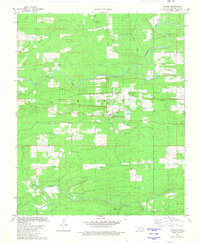
1981 Map of Watson
USGS Topo · Published 1981About this map
Watson and Beachton serve as the primary hubs for this rural landscape in the early 1980s, where life is shaped by the numerous watercourses winding through the hills. The Mountain Fork and Buffalo Creek provide the primary drainage for the area, while smaller tributaries like Mud Lick Creek and Roosevelt Ford Creek reveal the naming traditions of the local residents. This survey shows the location of important community anchors for genealogists, including Buffalo Church and the Watson Cem and Beechtree Cem. The terrain is defined by its drainage patterns, with Panther Creek and Sixmile Creek cutting through the forested hills, and Dry Creek suggesting the seasonal nature of the region's smaller streams. The map provides a clear picture of the road network connecting these isolated settlements and their local landmarks.
Find a feature on this map
19 named features on this map. Tap any name to fly to it.
Don’t see what you’re looking for? This feature index may not catch every label — zoom into the map to look around manually.
Map Details
Editions of this 1981 Watson Map
This is the sole edition of this map. No revisions or reprints were ever made.
Other maps of this area

1890 · Poteau Mountain
USGS Topo · 1:125,000

1899 · Poteau Mountain
USGS Topo · 1:125,000

1900 · Winding Stair
USGS Topo · 1:125,000

1902 · Lukfata
USGS Topo · 1:125,000

1909 · Winding Stair
USGS Topo · 1:125,000

1913 · De Queen
USGS Topo · 1:125,000

1950 · Mcalester
USGS Topo · 1:250,000

1958 · Potter
USGS Topo · 1:62,500

1958 · Zafra
USGS Topo · 1:24,000

1959 · Page
USGS Topo · 1:62,500