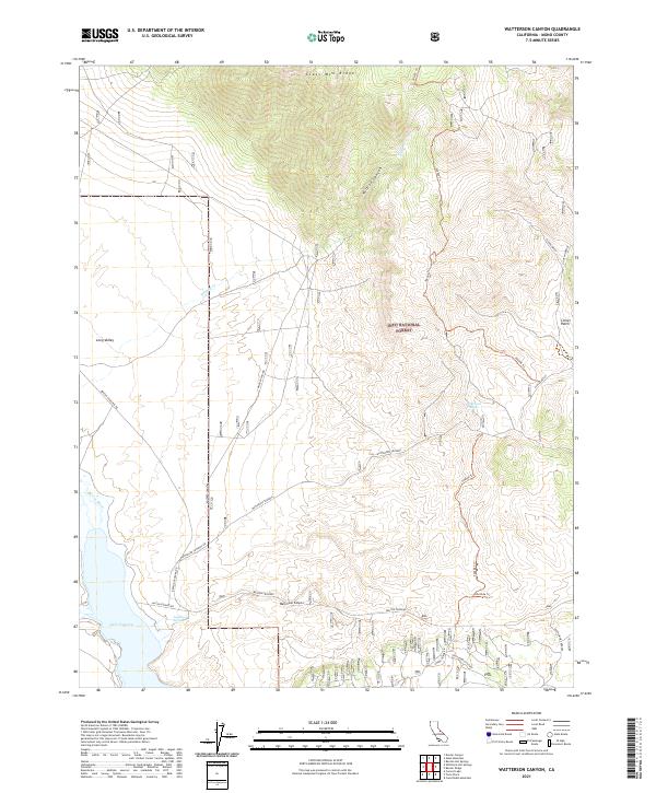
2021 Map of Watterson Canyon
USGS Topo · Published 2021About this map
Glass Mtn Ridge dominates the northern skyline of this high-elevation landscape, where the volcanic history of Long Valley meets the upper reaches of the Owens River. The terrain is defined by dramatic elevation changes, from the alluvial plains near Lake Crowley up through Wilfred Canyon and Watterson Canyon. Modern infrastructure and recreational access are traced through a network of forest service trails like 30e101 Trl and 30e306 Trl, which navigate the steep eastern slopes of the ridge. In the southern portion of the map, local water management and ranching history are evidenced by the Watterson Troughs and the small settlement area of Layton Springs. These features, situated within the Inyo National Forest, illustrate the traditional intersection of livestock grazing and watershed protection in Mono County.
Find a feature on this map
31 named features on this map. Tap any name to fly to it.
Don’t see what you’re looking for? This feature index may not catch every label — zoom into the map to look around manually.
Map Details
Editions of this 2021 Watterson Canyon Map
This is the sole edition of this map. No revisions or reprints were ever made.
Other maps of this area

1914 · Mt. Morrison
USGS Topo · 1:125,000

1947 · Mariposa
USGS Topo · 1:250,000

1948 · Mariposa
USGS Topo · 1:250,000

1953 · Mt. Morrison
USGS Topo · 1:62,500

1953 · Casa Diablo Mtn
USGS Topo · 1:62,500

1957 · Mariposa
USGS Topo · 1:250,000

1962 · Cowtrack Mtn
USGS Topo · 1:62,500

1962 · Glass Mountain
USGS Topo · 1:62,500

1963 · Mariposa
USGS Topo · 1:250,000
1983 · Whitmore Hot Sprs
USGS Topo · 1:24,000