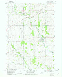
1981 Map of Waucoma
USGS Topo · Published 1982About this map
The Little Turkey River meanders through this portion of northeast Iowa, serving as the geographic anchor for the town of Waucoma. This early 1980s survey captures the region at a point of transition, where the Chicago Milwaukee St Paul and Pacific railroad still crosses the landscape while an Old RR Grade elsewhere suggests the receding footprint of earlier rail infrastructure. The map is particularly useful for genealogists, as it documents several rural religious and burial sites, including St Johns Ch, St Marys Cem, and Alpha Cem.
Find a feature on this map
24 named features on this map. Tap any name to fly to it.
Don’t see what you’re looking for? This feature index may not catch every label — zoom into the map to look around manually.
Map Details
Editions of this 1981 Waucoma Map
This is the sole edition of this map. No revisions or reprints were ever made.
Other maps of this area

1901 · Oelwein
USGS Topo · 1:125,000

1906 · Decorah
USGS Topo · 1:125,000

1954 · Mason City
USGS Topo · 1:250,000

1954 · Waterloo
USGS Topo · 1:250,000

1955 · Waterloo
USGS Topo · 1:250,000

1957 · Mason City
USGS Topo · 1:250,000

1958 · Mason City
USGS Topo · 1:250,000

1958 · La Crosse
USGS Topo · 1:250,000

1959 · Dubuque
USGS Topo · 1:250,000

1961 · Dubuque
USGS Topo · 1:250,000