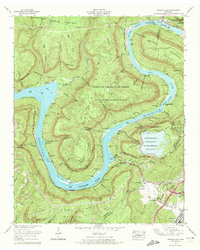
1970 Map of Wauhatchie
USGS Topo · Published 1972About this map
Nickajack Lake and the winding Tennessee River dominate this 1970 landscape, carving through the high plateau of Raccoon Mountain and Prentice Cooper State Forest. The map documents a significant era of infrastructure development, specifically the Raccoon Mountain Pumped Storage Dam and Reservoir shown during its construction phase. The river’s natural hazards and navigational landmarks, such as Suck Shoals, Deadman Eddy, and The Pot, remain prominent alongside the modern industrial footprint of the Wauhatchie Yards. Local history is preserved through numerous family cemeteries including McNabb Cem and Francis Cem, while the rugged geology is evidenced by Crystal Cave and Grant Cave. A network of old routes like Kellys Ferry Road and the Dixie Highway connect the riverside communities and mining areas at Aetna.
Find a feature on this map
67 named features on this map. Tap any name to fly to it.
Don’t see what you’re looking for? This feature index may not catch every label — zoom into the map to look around manually.
Map Details
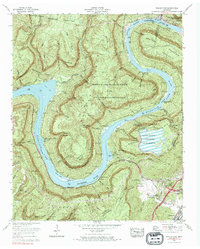
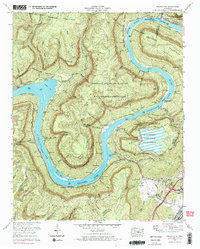
Editions of this 1970 Wauhatchie Map
3 editions found
Other maps of this area

1886 · Ringgold
USGS Topo · 1:125,000

1886 · Stevenson
USGS Topo · 1:125,000

1888 · Chattanooga
USGS Topo · 1:125,000

1892 · Ringgold
USGS Topo · 1:125,000

1892 · Stevenson
USGS Topo · 1:125,000

1893 · Chattanooga
USGS Topo · 1:125,000

1895 · Stevenson
USGS Topo · 1:125,000

1895 · Sewanee
USGS Topo · 1:125,000

1936 · Shellmound
USGS Topo · 1:24,000

1936 · Whitwell
USGS Topo · 1:24,000