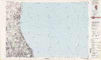
1980 Map of Waukegan
USGS Topo · Published 1980About this map
Lake Michigan dominates the eastern half of this 1980 survey, framing the dense suburban and industrial corridor stretching from the Wisconsin Illinois border down toward Chicago. The map highlights a landscape heavily defined by military and educational institutions, most notably the Great Lakes Naval Training Center, Fort Sheridan, and the Glenview Naval Air Station. Inland, the Des Plaines River and Mill Creek cut through a grid increasingly defined by the Tri-State Tollway and Edens Expy, while the routes of the Chicago and North Western and the Milwaukee Road reflect the area's deep-seated commuter and freight rail history. Educational hubs like Northwestern University and Loyola University are established anchors along the shore. This record captures the North Shore at a peak of late-century development, balancing residential growth in places like Libertyville and Buffalo Grove with large-scale infrastructure like Chicago-O'Hare Intl Airport.
Find a feature on this map
114 named features on this map. Tap any name to fly to it.
Don’t see what you’re looking for? This feature index may not catch every label — zoom into the map to look around manually.
Map Details
Editions of this 1980 Waukegan Map
This is the sole edition of this map. No revisions or reprints were ever made.
Other maps of this area

1889 · Chicago
USGS Topo · 1:62,500

1891 · Chicago
USGS Topo · 1:62,500

1891 · Riverside
USGS Topo · 1:62,500

1892 · Racine
USGS Topo · 1:62,500

1893 · Riverside
USGS Topo · 1:62,500

1893 · Silver Lake
USGS Topo · 1:62,500

1899 · Evanston
USGS Topo · 1:62,500

1900 · Chicago
USGS Topo · 1:62,500

1900 · Riverside
USGS Topo · 1:62,500

1900 · Highwood
USGS Topo · 1:62,500