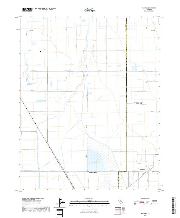
2021 Map of Waukena
USGS Topo · Published 2021About this map
Waukena and the surrounding agricultural expanse of the San Joaquin Valley are defined by a complex irrigation network and a precise grid of rural roads. This region of the Central Valley relies on man-made waterways like the Highline Canal, W Br Lakeland Canal, and the East-Branch-Cross-Creek to sustain its massive fields. The settlement of Waukena is oriented along the Waukena Ave and Rd 28 junction, while the boundary with Corcoran marks the southwestern edge of this survey. Cultural markers like the Lakeside Cem on Kent Ave provide fixed points for genealogists within a landscape of shifting water features including Guernsey Slough and Bean Ditch. The map illustrates the intensive hydrologic engineering required to manage the drainage and distribution of water across the flat valley floor.
Find a feature on this map
50 named features on this map. Tap any name to fly to it.
Don’t see what you’re looking for? This feature index may not catch every label — zoom into the map to look around manually.
Map Details
Editions of this 2021 Waukena Map
This is the sole edition of this map. No revisions or reprints were ever made.
Other maps of this area

1926 · Goshen
USGS Topo · 1:31,680

1926 · Hanford
USGS Topo · 1:31,680

1927 · Remnoy
USGS Topo · 1:31,680

1927 · Lake View School
USGS Topo · 1:31,680

1927 · Paige
USGS Topo · 1:31,680

1928 · Waukena
USGS Topo · 1:31,680

1928 · Corcoran
USGS Topo · 1:31,680

1929 · Guernsey
USGS Topo · 1:31,680

1932 · El Rico Ranch
USGS Topo · 1:31,680
1936 · El Rico Ranch
USGS Topo · 1:31,680