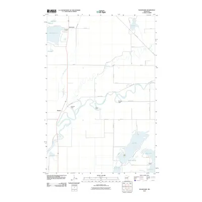
2010 Map of Waukenabo
USGS Topo · Published 2010About this map
The Mississippi River winds through this northern landscape, forming a complex hydrologic network alongside the Willow River and White Elk Creek. This area in Aitkin County is defined by its numerous water bodies, ranging from the large Waukenabo Lake and Gun Lake to the smaller Rice Lake and Whispering Lake. The settlement of Waukenabo and the nearby Waukenabo Cemetery serve as local anchors in a region where the land is carved by glacial lakes and sluggish river meanders.
Find a feature on this map
47 named features on this map. Tap any name to fly to it.
Don’t see what you’re looking for? This feature index may not catch every label — zoom into the map to look around manually.
Map Details
Editions of this 2010 Waukenabo Map
This is the sole edition of this map. No revisions or reprints were ever made.
Other maps of this area

1914 · Aitkin
USGS Topo · 1:62,500

1915 · Aitkin
USGS Topo · 1:62,500

1953 · Duluth
USGS Topo · 1:250,000

1958 · Duluth
USGS Topo · 1:250,000

1970 · Kimberly
USGS Topo · 1:24,000

1970 · Palisade
USGS Topo · 1:24,000

1970 · Sanders Lake
USGS Topo · 1:24,000

1970 · Bain
USGS Topo · 1:24,000

1970 · White Elk Lake
USGS Topo · 1:24,000
1973 · Waukenabo
USGS Topo · 1:24,000