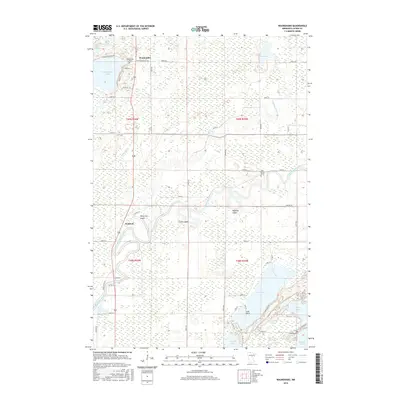
2016 Map of Waukenabo
USGS Topo · Published 2016About this map
Waukenabo and Waldeck anchor this landscape where the Mississippi River winds through a complex system of wetlands and lakes in northern Minnesota. The area is defined by its abundance of water bodies, including the expansive Gun Lake and Waukenabo Lake, which are linked by smaller tributaries like White Elk Cr and the Willow River. The settlement pattern follows the high ground between these waters, with distinct family-named clusters such as White Elk Logan, Clark Logan, and Maydole Logan scattered across the township. For genealogists and local historians, the map provides precise locations for the Waukenabo Cem, Pine Grove Cem, and Fleming Cem, marking the spiritual and communal centers of this Aitkin County area. The intricate network of township roads and county highways, such as Co HWY 10 and Co RD 78, illustrates how modern transportation has adapted to the natural contours of the river valleys and glacial lake beds.
Find a feature on this map
99 named features on this map. Tap any name to fly to it.
Don’t see what you’re looking for? This feature index may not catch every label — zoom into the map to look around manually.
Map Details
Editions of this 2016 Waukenabo Map
This is the sole edition of this map. No revisions or reprints were ever made.
Other maps of this area

1914 · Aitkin
USGS Topo · 1:62,500

1915 · Aitkin
USGS Topo · 1:62,500

1953 · Duluth
USGS Topo · 1:250,000

1958 · Duluth
USGS Topo · 1:250,000

1970 · Kimberly
USGS Topo · 1:24,000

1970 · Palisade
USGS Topo · 1:24,000

1970 · Sanders Lake
USGS Topo · 1:24,000

1970 · Bain
USGS Topo · 1:24,000

1970 · White Elk Lake
USGS Topo · 1:24,000
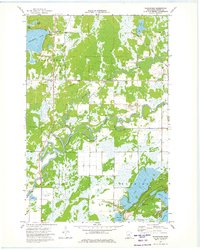
1973 · Waukenabo
USGS Topo · 1:24,000