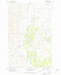
1973 Map of Waukon
USGS Topo · Published 1977About this map
The Waukon grain elevator and the tracks of the Burlington Northern railroad anchor this agricultural landscape along the border of Lincoln and Spokane counties. In the early 1970s, the region's economy is clearly defined by its transport infrastructure and land use, ranging from the flat expanses of Tucker Prairie and Malloy Prairie to the water sources at Hedin Lake and Lonelyville Lake. The settlement of Hallett and the local Grange Hall serve as social and industrial focal points for the surrounding farming community.
Find a feature on this map
23 named features on this map. Tap any name to fly to it.
Don’t see what you’re looking for? This feature index may not catch every label — zoom into the map to look around manually.
Map Details
Editions of this 1973 Waukon Map
This is the sole edition of this map. No revisions or reprints were ever made.
Other maps of this area

1943 · Medical Lake
USGS Topo · 1:62,500

1945 · Reardan
USGS Topo · 1:62,500

1953 · Reardan
USGS Topo · 1:62,500

1954 · Medical Lake
USGS Topo · 1:24,000

1954 · Medical Lake
USGS Topo · 1:62,500

1954 · Cheney
USGS Topo · 1:62,500

1954 · Sprague
USGS Topo · 1:62,500

1954 · Deep Creek
USGS Topo · 1:24,000

1955 · Spokane
USGS Topo · 1:250,000

1958 · Spokane
USGS Topo · 1:250,000