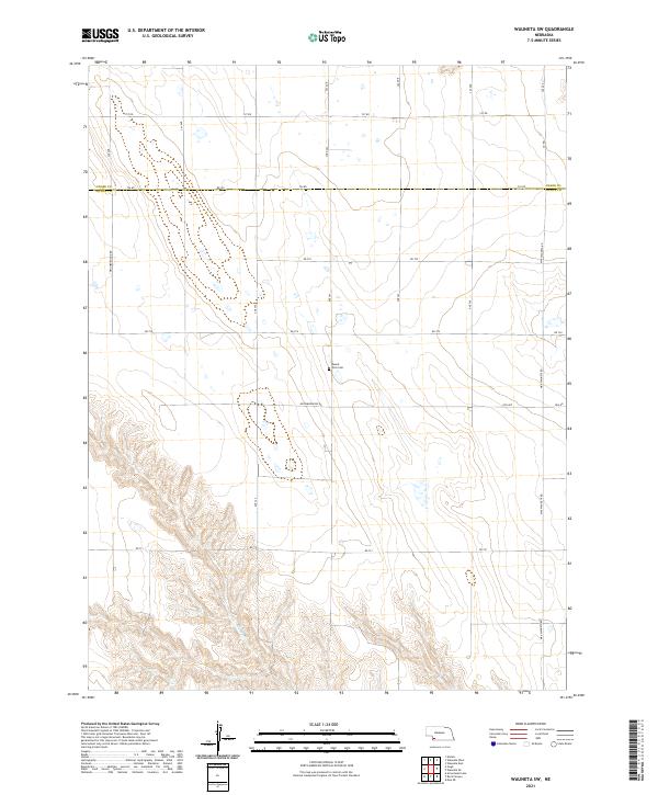
2021 Map of Wauneta SW
USGS Topo · Published 2021About this map
The boundary between Chase and Dundy Counties bisects this corner of southwest Nebraska, where the High Plains landscape is defined by a grid of rural section roads and deep drainage ravines. In the southern portion of the map, the terrain descends into the breaks formed by Muddy Cr, revealing a complex system of draws and ridges that stand in contrast to the level agricultural fields to the north. Mount Zion Cem sits isolated along Ave 343, serving as a quiet landmark for local family history and the early settlement of this region. The infrastructure is primarily composed of established county lines such as Max-Wauneta Rd and Neighborhood Rd, which facilitate transport through this sparsely populated agricultural area.
Find a feature on this map
27 named features on this map. Tap any name to fly to it.
Don’t see what you’re looking for? This feature index may not catch every label — zoom into the map to look around manually.
Map Details
Editions of this 2021 Wauneta SW Map
This is the sole edition of this map. No revisions or reprints were ever made.
Other maps of this area

1954 · McCook
USGS Topo · 1:250,000

1957 · McCook
USGS Topo · 1:250,000

1958 · McCook
USGS Topo · 1:250,000

1962 · Max NE
USGS Topo · 1:24,000

1973 · Enders
USGS Topo · 1:24,000

1973 · Ough
USGS Topo · 1:24,000

1973 · Wauneta SW
USGS Topo · 1:24,000
1973 · Rock Canyon
USGS Topo · 1:24,000

1973 · Wauneta SE
USGS Topo · 1:24,000
1973 · Arrowhead Lake
USGS Topo · 1:24,000