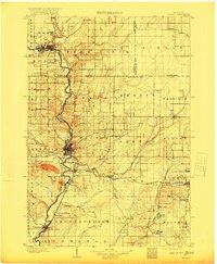
1902 Map of Wausau
USGS Topo · Published 1920About this map
The Wisconsin River corridor dominates this central Wisconsin landscape at the turn of the century, serving as the industrial spine for the lumber and milling centers of Wausau and Merrill. This survey captures a period of intense rail expansion, where the Chicago Milwaukee and St Paul and Chicago and Northwestern lines intersect the river economy. Notable local landmarks include the State Insane Asylum south of Wausau and the distinct elevation of Rib Hill, which towers over the surrounding timberlands. Beyond the main river valley, the map details numerous rural junctions and hamlets like Dessert Junction and Granite Heights. The complex drainage of the Eau Claire River and Trapp River feeds into the primary waterway, illustrating the natural geography that dictated the early settlement patterns of Marathon and Lincoln Counties.
Find a feature on this map
72 named features on this map. Tap any name to fly to it.
Don’t see what you’re looking for? This feature index may not catch every label — zoom into the map to look around manually.
Map Details
Editions of this 1902 Wausau Map
2 editions found
Other maps of this area

1899 · Wausau
USGS Topo · 1:125,000

1902 · Wausau
USGS Topo · 1:125,000

1902 · Marathon
USGS Topo · 1:125,000

1940 · Parrish
USGS Topo · 1:48,000

1942 · Elcho
USGS Topo · 1:48,000

1950 · Elcho
USGS Topo · 1:48,000

1950 · Parrish
USGS Topo · 1:48,000

1950 · Tomahawk
USGS Topo · 1:48,000

1950 · Spirit Falls
USGS Topo · 1:48,000

1951 · Doering
USGS Topo · 1:48,000