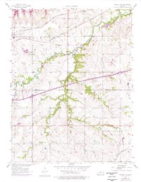
1957 Map of Waverly NW
USGS Topo · Published 1976About this map
Melvern Lake dominates the northern landscape of this Kansas quadrangle, where the waters meet the winding course of Long Creek. The area preserves a distinct historical transition, marked clearly by the Old Indian Boundary that cuts across the southern portion of the map. This line serves as a reminder of earlier land divisions and settlement patterns in the Flint Hills region. Along the northern edge, the Atchison Topeka and Santa Fe railroad corridor follows the valley, supporting the small community of Olivet and its nearby Olivet Cem. Further south, the intersection of modern transportation is evident at Beto Junction, while the terrain is defined by a dense network of waterways including Frog Creek, Sand Creek, and Rock Creek, which illustrate the natural drainage of the Osage and Coffey county line.
Find a feature on this map
17 named features on this map. Tap any name to fly to it.
Don’t see what you’re looking for? This feature index may not catch every label — zoom into the map to look around manually.
Map Details
Editions of this 1957 Waverly NW Map
3 editions found
Other maps of this area

1885 · Burlington
USGS Topo · 1:125,000

1889 · Burlingame
USGS Topo · 1:125,000

1894 · Burlingame
USGS Topo · 1:125,000

1894 · Burlington
USGS Topo · 1:125,000

1947 · Lawrence
USGS Topo · 1:250,000

1950 · Lawrence
USGS Topo · 1:250,000

1956 · Lawrence
USGS Topo · 1:250,000

1957 · Lebo
USGS Topo · 1:24,000

1957 · Waverly NW
USGS Topo · 1:24,000

1957 · Waverly
USGS Topo · 1:24,000