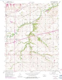
1957 Map of Waverly NW
USGS Topo · Published 1983About this map
The Atchison Topeka and Santa Fe RR cuts across the northern landscape of this Kansas quadrangle, connecting the settlements of Olivet and Melvern. This 1957 record, updated with 1980s data, illustrates the significant impact of water management on the terrain, notably the presence of Melvern Lake. The map reveals the intricate drainage system of the region, where Frog Creek, Long Creek, and Sand Creek converge into the larger Rock Creek basin.
Find a feature on this map
17 named features on this map. Tap any name to fly to it.
Don’t see what you’re looking for? This feature index may not catch every label — zoom into the map to look around manually.
Map Details
Editions of this 1957 Waverly NW Map
3 editions found
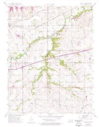
Other maps of this area

1885 · Burlington
USGS Topo · 1:125,000

1889 · Burlingame
USGS Topo · 1:125,000

1894 · Burlingame
USGS Topo · 1:125,000

1894 · Burlington
USGS Topo · 1:125,000

1947 · Lawrence
USGS Topo · 1:250,000

1950 · Lawrence
USGS Topo · 1:250,000

1956 · Lawrence
USGS Topo · 1:250,000

1957 · Lebo
USGS Topo · 1:24,000

1957 · Waverly NW
USGS Topo · 1:24,000

1957 · Waverly
USGS Topo · 1:24,000