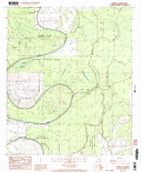
1987 Map of Waverly SE
USGS Topo · Published 1987About this map
The Tensas River meanders in tight oxbows through this landscape in Madison Parish, reflecting the complex hydrological history of the Mississippi River floodplain. Much of the terrain is defined by the Tensas National Wildlife Refuge, where bottomland hardwood forest environments are marked by numerous named brakes and bayous. Significant water bodies such as Horseshoe Lake, Big Rainey Lake, and Wolf Lake indicate the path of former river channels, while features like Rainey Brake and Bear Wallow suggest the seasonally flooded nature of the ground. Human activity in this conservation area is represented by a small network of unimproved roads and a Foot Bridge crossing the river, emphasizing the transition from former agricultural or timber land to protected habitat. Other waterways, including Alligator Bayou and Mack Bayou, crisscross the area, serving as a reminder of the intricate drainage patterns essential to this part of Louisiana.
Find a feature on this map
23 named features on this map. Tap any name to fly to it.
Don’t see what you’re looking for? This feature index may not catch every label — zoom into the map to look around manually.
Map Details
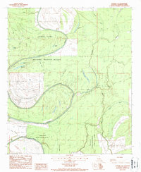
Editions of this 1987 Waverly SE Map
2 editions found
Other maps of this area

1909 · Tallulah
USGS Topo · 1:24,000

1935 · Waverly
USGS Topo · 1:62,500

1935 · Shackleford Lake
USGS Topo · 1:62,500

1939 · Talla Bena
USGS Topo · 1:62,500

1955 · Jackson
USGS Topo · 1:250,000

1958 · Shackleford Lake
USGS Topo · 1:62,500

1961 · Jackson
USGS Topo · 1:250,000

1961 · Waverly
USGS Topo · 1:62,500

1962 · Jackson
USGS Topo · 1:250,000
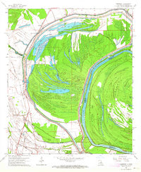
1963 · Somerset
USGS Topo · 1:24,000