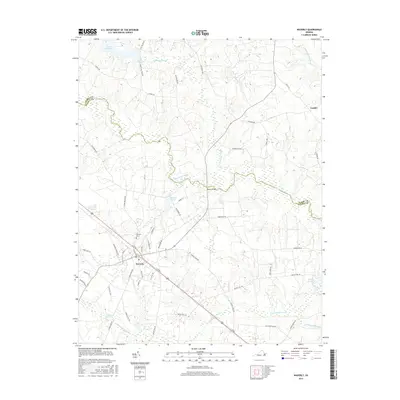
2016 Map of Waverly
USGS Topo · Published 2016About this map
The town of Waverly serves as the central hub of this Sussex County landscape, where the street grid transitions into a vast network of wooded wetlands and agricultural tracts. The area is defined by the winding course of the Blackwater River, which is fed by numerous drainages including the massive Otterdam Swamp and Chinquapin Swamp. Near the river, the crossing at Blunts Bridge provides a key point of transit through the low-lying terrain. To the north, the smaller settlement of Carsley sits among family-named routes and timbered reaches.
Find a feature on this map
54 named features on this map. Tap any name to fly to it.
Don’t see what you’re looking for? This feature index may not catch every label — zoom into the map to look around manually.
Map Details
Editions of this 2016 Waverly Map
This is the sole edition of this map. No revisions or reprints were ever made.
Other maps of this area

1919 · Surry
USGS Topo · 1:62,500

1919 · Disputanta
USGS Topo · 1:62,500

1919 · Homeville
USGS Topo · 1:48,000

1920 · Ivor
USGS Topo · 1:62,500

1920 · Homeville
USGS Topo · 1:62,500

1943 · Manry
USGS Topo · 1:31,680

1943 · Littleton
USGS Topo · 1:31,680

1943 · Savedge
USGS Topo · 1:31,680

1943 · Disputanta
USGS Topo · 1:31,680

1943 · Richmond
USGS Topo · 1:250,000