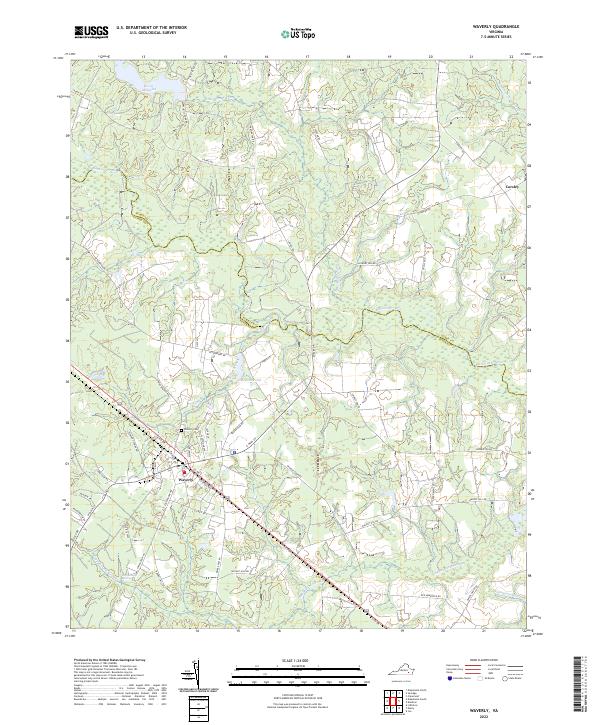
2022 Map of Waverly
USGS Topo · Published 2022About this map
The town of Waverly serves as the central hub of this Tidewater Virginia landscape, where the flat coastal plain is defined by a complex network of slow-moving waterways and wetland systems. To the north and east, the Blackwater River and Otterdam Swamp carve meandering paths through the terrain, while Coppahaunk Swamp and Chinquapin Swamp dominate the southern reaches. These drainage patterns have historically influenced local transit and land use, with roads like Petersburg Rd and Walnut Hill Rd navigating around the water-saturated lowlands.
Find a feature on this map
54 named features on this map. Tap any name to fly to it.
Don’t see what you’re looking for? This feature index may not catch every label — zoom into the map to look around manually.
Map Details
Editions of this 2022 Waverly Map
This is the sole edition of this map. No revisions or reprints were ever made.
Other maps of this area

1919 · Surry
USGS Topo · 1:62,500

1919 · Disputanta
USGS Topo · 1:62,500

1919 · Homeville
USGS Topo · 1:48,000

1920 · Ivor
USGS Topo · 1:62,500

1920 · Homeville
USGS Topo · 1:62,500

1943 · Manry
USGS Topo · 1:31,680

1943 · Littleton
USGS Topo · 1:31,680

1943 · Savedge
USGS Topo · 1:31,680

1943 · Disputanta
USGS Topo · 1:31,680

1943 · Richmond
USGS Topo · 1:250,000