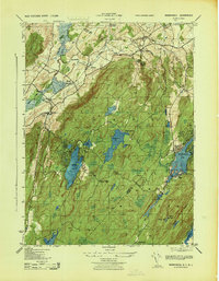
1943 Map of Wawayanda
USGS Topo · Published 1943About this map
Vernon Valley and the surrounding highlands of the New York-New Jersey border area are depicted here during the early years of the Second World War. The landscape is defined by its prominent ridgelines and water bodies, with Pochuck Mountain to the west and Bearfort Mountain to the east. Transportation patterns of the era are visible through the route of the Lehigh and Hudson River railroad, which served the village of Vernon and the Vernon Station area.
Find a feature on this map
40 named features on this map. Tap any name to fly to it.
Don’t see what you’re looking for? This feature index may not catch every label — zoom into the map to look around manually.
Map Details
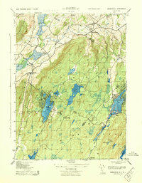
Editions of this 1943 Wawayanda Map
2 editions found
Other maps of this area

1888 · Franklin
USGS Topo · 1:62,500

1891 · Greenwood Lake
USGS Topo · 1:62,500

1893 · Greenwood Lake
USGS Topo · 1:62,500

1894 · Franklin
USGS Topo · 1:62,500

1897 · Franklin
USGS Topo · 1:62,500

1903 · Franklin Furnace
USGS Topo · 1:62,500

1903 · Greenwood Lake
USGS Topo · 1:62,500

1906 · Port Jervis
USGS Topo · 1:62,500

1906 · Goshen
USGS Topo · 1:62,500

1908 · Goshen
USGS Topo · 1:62,500