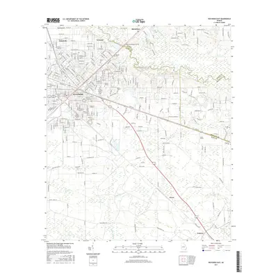
2017 Map of Waycross East
USGS Topo · Published 2017About this map
Waycross serves as the focal point of this region, where dense street grids like Knight Ave and Miller St transition into the surrounding wetlands and timberlands of Ware and Brantley Counties. The geography is defined by the winding course of the Satilla River and its numerous tributaries, including Caney Br and Bailey Br. This landscape of swamps and bays, such as Boggy Bay and Duboise Bay, suggests a history of difficult passage and specialized land use in the Georgia coastal plain.
Find a feature on this map
145 named features on this map. Tap any name to fly to it.
Don’t see what you’re looking for? This feature index may not catch every label — zoom into the map to look around manually.
Map Details
Editions of this 2017 Waycross East Map
This is the sole edition of this map. No revisions or reprints were ever made.
Other maps of this area

1953 · Waycross
USGS Topo · 1:250,000

1958 · Waycross
USGS Topo · 1:250,000

1967 · Waycross SE
USGS Topo · 1:24,000
1967 · Fort Mudge
USGS Topo · 1:24,000

1967 · Hoboken West
USGS Topo · 1:24,000

1967 · Waycross West
USGS Topo · 1:24,000

1967 · Waycross East
USGS Topo · 1:24,000

1967 · Waycross SW
USGS Topo · 1:24,000

1971 · Dixie Union
USGS Topo · 1:24,000

1971 · Blackshear East
USGS Topo · 1:24,000