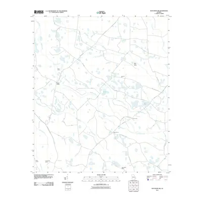
2011 Map of Waycross SW
USGS Topo · Published 2011About this map
Three Points serves as a central junction in this corner of Ware County, where rural roads like Eight Mile Post Rd and Byrd Rd weave through a complex landscape of wetlands and timberland. The area is defined by its intricate hydrology, including the winding Alligator Creek, Suwannee Creek, and the curiously named Botherment Branch. Local history and genealogy researchers will find the Carter Cemetery situated near Old Swamp Rd, providing a specific point of reference for families of the district. Distinctive terrain features rise above the surrounding lowlands, such as Bush Island and Hog Gallus Island, while historic survey markers like the Twelvemile Post and Fifteenmile Post remain as legacy landmarks of the region's early boundaries and distance measurements. The map also documents named water features like Water Bay and Bear Belly Strand, which characterize the interior drainage patterns of the South Georgia wetlands.
Find a feature on this map
36 named features on this map. Tap any name to fly to it.
Don’t see what you’re looking for? This feature index may not catch every label — zoom into the map to look around manually.
Map Details
Editions of this 2011 Waycross SW Map
This is the sole edition of this map. No revisions or reprints were ever made.
Other maps of this area

1953 · Waycross
USGS Topo · 1:250,000

1954 · Valdosta
USGS Topo · 1:250,000

1958 · Valdosta
USGS Topo · 1:250,000

1958 · Waycross
USGS Topo · 1:250,000

1959 · Valdosta
USGS Topo · 1:250,000

1965 · Dinner Pond
USGS Topo · 1:24,000

1966 · Cravens Island
USGS Topo · 1:24,000

1967 · Waycross SE
USGS Topo · 1:24,000

1967 · Spooner
USGS Topo · 1:24,000

1967 · Waycross West
USGS Topo · 1:24,000