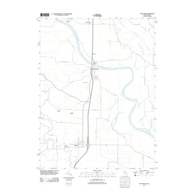
2012 Map of Wayland
USGS Topo · Published 2012About this map
Wayland and the winding course of the Des Moines River define this corner of Clark County, Missouri. The river serves as a prominent boundary, its banks home to the small settlement of Saint Francisville, where the Saint Francisville Bridge provides a crossing point. This area is characterized by a network of waterways including the Fox River and Weaver Branch, supporting local infrastructure like the Wayland Bridge and the Glades Lake Dam. Small communities and agricultural lands are connected by a grid of county roads such as Old St Francisville Rd and Belfast Rd. Genealogists and local historians will find several burial sites preserved across the landscape, including Oakland Cemetery, Sand Cemetery, and Oak Hill Cemetery. The presence of Moores Mill and Vincennes further illustrates the localized commerce and settlement patterns established along the river valleys and upland plains.
Find a feature on this map
52 named features on this map. Tap any name to fly to it.
Don’t see what you’re looking for? This feature index may not catch every label — zoom into the map to look around manually.
Map Details
Editions of this 2012 Wayland Map
This is the sole edition of this map. No revisions or reprints were ever made.
Other maps of this area

1903 · Kahoka
USGS Topo · 1:125,000

1936 · Keokuk
USGS Topo · 1:62,500

1936 · Fort Madison
USGS Topo · 1:62,500

1949 · Wayland
USGS Topo · 1:24,000

1949 · Kahoka SE
USGS Topo · 1:24,000

1949 · Kahoka
USGS Topo · 1:24,000

1949 · St. Patrick
USGS Topo · 1:24,000

1950 · Kahoka
USGS Topo · 1:24,000

1950 · Saint Patrick
USGS Topo · 1:24,000

1950 · Kahoka SE
USGS Topo · 1:24,000