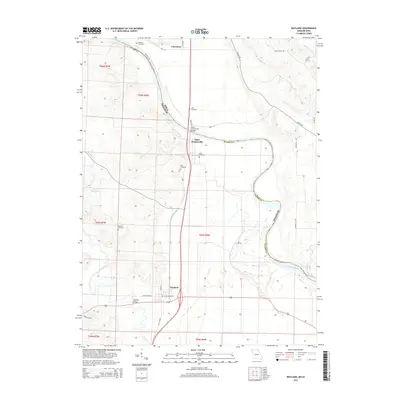
2015 Map of Wayland
USGS Topo · Published 2015About this map
The Des Moines River forms a winding natural border between Clark Co, Missouri, and the state of Iowa, defining the eastern edge of this 2015 survey. Along its banks, the settlement of Saint Francisville and the Saint Francisville Bridge mark a historical crossing point where the river meanders through the fertile bottomlands. Further south, the town of Wayland serves as a local hub, situated near the Fox River and the Wayland Bridge. The agricultural landscape is dotted with ancestral landmarks, including the Oak Hill Cemetery and Wolf Cemetery, which offer valuable points of reference for genealogists. The map also captures the smaller community of Vincennes in the north and the secluded Winter- Wood Lake to the west, illustrating a region shaped by its proximity to significant river systems and a network of rural roads like Argyle Rd.
Find a feature on this map
39 named features on this map. Tap any name to fly to it.
Don’t see what you’re looking for? This feature index may not catch every label — zoom into the map to look around manually.
Map Details
Editions of this 2015 Wayland Map
This is the sole edition of this map. No revisions or reprints were ever made.
Other maps of this area

1903 · Kahoka
USGS Topo · 1:125,000

1936 · Keokuk
USGS Topo · 1:62,500

1936 · Fort Madison
USGS Topo · 1:62,500

1949 · Wayland
USGS Topo · 1:24,000

1949 · Kahoka SE
USGS Topo · 1:24,000

1949 · Kahoka
USGS Topo · 1:24,000

1949 · St. Patrick
USGS Topo · 1:24,000

1950 · Kahoka
USGS Topo · 1:24,000

1950 · Saint Patrick
USGS Topo · 1:24,000

1950 · Kahoka SE
USGS Topo · 1:24,000