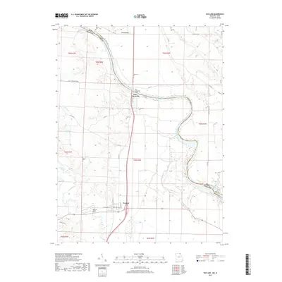
2017 Map of Wayland
USGS Topo · Published 2017About this map
The Des Moines River defines the sweeping border between Missouri and Iowa in this northern corner of Clark County. The settlement of Saint Francisville sits at a sharp bend in the river, connected to Lee County by the Saint Francisville Bridge. This area is characterized by a high density of small family and community burial grounds, including Sand Cem, Wolf Cem, and Oakland Cem, which provide essential touchpoints for genealogical research in the tri-state region.
Find a feature on this map
40 named features on this map. Tap any name to fly to it.
Don’t see what you’re looking for? This feature index may not catch every label — zoom into the map to look around manually.
Map Details
Editions of this 2017 Wayland Map
This is the sole edition of this map. No revisions or reprints were ever made.
Other maps of this area

1903 · Kahoka
USGS Topo · 1:125,000

1936 · Keokuk
USGS Topo · 1:62,500

1936 · Fort Madison
USGS Topo · 1:62,500

1949 · Wayland
USGS Topo · 1:24,000

1949 · Kahoka SE
USGS Topo · 1:24,000

1949 · Kahoka
USGS Topo · 1:24,000

1949 · St. Patrick
USGS Topo · 1:24,000

1950 · Kahoka
USGS Topo · 1:24,000

1950 · Saint Patrick
USGS Topo · 1:24,000

1950 · Kahoka SE
USGS Topo · 1:24,000