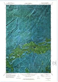
1973 Map of Wayland SE
USGS Topo · Published 1976About this map
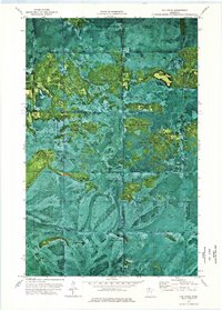
Pine Island State Forest dominates this northern Minnesota landscape, showing a complex mosaic of peatlands and timber as it appeared in the early 1970s. The orthophotomap imagery reveals the intricate, finger-like patterns of vegetation and water across the Red Lake Indian Reservation, which occupies the northern and southern portions of the sheet. Evidence of human passage through this remote terrain is sparse, marked primarily by a Winter Trail cutting through the northern section and a small Gravel pit in the south. This transition zone between tribal and state lands reflects the wilderness character of Koochiching County, where drainage patterns and forest density were the primary features of interest for land management and conservation during this era.
Find a feature on this map
7 named features on this map. Tap any name to fly to it.
Don’t see what you’re looking for? This feature index may not catch every label — zoom into the map to look around manually.
Map Details
Editions of this 1973 Wayland SE Map
This is the sole edition of this map. No revisions or reprints were ever made.
Other maps of this area

1919 · Lundgren
USGS Topo · 1:62,500

1919 · Norden
USGS Topo · 1:62,500

1919 · I
USGS Topo · 1:62,500

1954 · Roseau
USGS Topo · 1:250,000

1957 · Roseau
USGS Topo · 1:250,000

1958 · Roseau
USGS Topo · 1:250,000
1973 · Ridge NW
USGS Topo · 1:24,000
1973 · Norman Lake
USGS Topo · 1:24,000
1973 · Wayland SW
USGS Topo · 1:24,000
1973 · The Pines
USGS Topo · 1:24,000