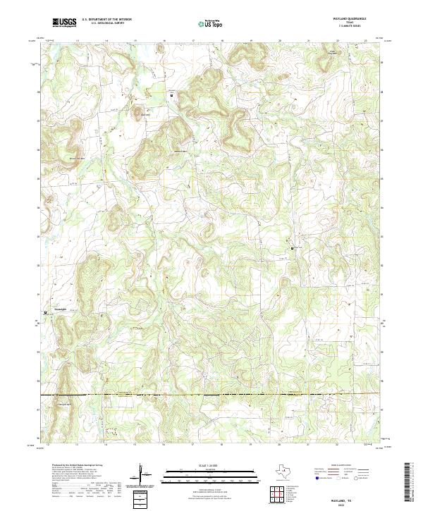
2022 Map of Wayland
USGS Topo · Published 2022About this map
Gunsight stands at the western edge of this landscape where the drainage systems of Gunsolus Cr and Colony Cr meet. The terrain is defined by a series of prominent elevations including Gunsight Mtn, Bald Mtn, and the curiously named Steal Easy Mtn to the northeast. This part of North Central Texas shows a dispersed settlement pattern typical of the region's ranching and agricultural history, anchored by small community hubs and family burial grounds. Local genealogists will find several significant sites, such as Gunsight Cem, Wayland Cem, and Acker Cem, which are tucked away among the many forks of the creeks. The intricate network of county roads, such as Co RD 154 and Co RD 124, winds through the breaks of the Middle Fork Gunsolus Cr and W Fork Gunsolus Cr, following the natural topography created by the numerous ridges and hills that break the horizon.
Find a feature on this map
37 named features on this map. Tap any name to fly to it.
Don’t see what you’re looking for? This feature index may not catch every label — zoom into the map to look around manually.
Map Details
Editions of this 2022 Wayland Map
This is the sole edition of this map. No revisions or reprints were ever made.
Other maps of this area

1890 · Breckenridge
USGS Topo · 1:125,000

1894 · Eastland
USGS Topo · 1:125,000

1954 · Abilene
USGS Topo · 1:250,000

1958 · Abilene
USGS Topo · 1:250,000

1961 · Buck Mountain
USGS Topo · 1:24,000

1966 · Cisco North
USGS Topo · 1:24,000

1966 · Eastland
USGS Topo · 1:24,000

1966 · Ranger
USGS Topo · 1:24,000
1967 · Wayland
USGS Topo · 1:24,000

1967 · Necessity
USGS Topo · 1:24,000