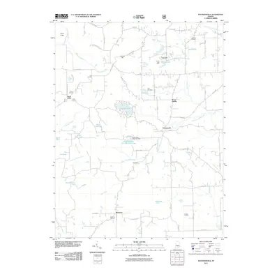
2011 Map of Waymansville
USGS Topo · Published 2011About this map
Waymansville and the rural townships of Bartholomew County are captured in this detailed 2011 survey, showing a landscape defined by small settlements and family burial grounds. Local history is etched into the terrain at Becks Grove and Mount Healthy, where family-named sites like Beck Cemetery and Phillips Cemetery offer valuable data for genealogists. The area’s water management is evident in numerous man-made bodies, including Lutheran Lake and the Fraternal Order Columbus Police Lake, which sit among the drainage of White Creek and South Fork White Creek.
Find a feature on this map
78 named features on this map. Tap any name to fly to it.
Don’t see what you’re looking for? This feature index may not catch every label — zoom into the map to look around manually.
Map Details
Editions of this 2011 Waymansville Map
This is the sole edition of this map. No revisions or reprints were ever made.
Other maps of this area

1942 · Franklin
USGS Topo · 1:125,000

1942 · Columbus
USGS Topo · 1:125,000

1947 · Nashville
USGS Topo · 1:24,000

1948 · New Bellsville
USGS Topo · 1:24,000

1948 · Waymansville
USGS Topo · 1:24,000

1949 · Nashville
USGS Topo · 1:24,000

1953 · Cincinnati
USGS Topo · 1:250,000

1953 · Indianapolis
USGS Topo · 1:250,000

1956 · Indianapolis
USGS Topo · 1:250,000

1956 · Story
USGS Topo · 1:24,000