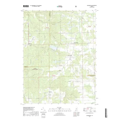
2019 Map of Waymansville
USGS Topo · Published 2019About this map
Waymansville and the surrounding borderlands of Bartholomew, Brown, and Jackson counties are defined by a network of creeks and timbered ridges. This modern survey illustrates the rural character of south-central Indiana, where small settlements like Becks Grove and Spraytown anchor the agricultural landscape. The western portion of the area is heavily influenced by the Hoosier National Forest, which covers the varied topography of Poplar Ridge and Gilmore Hill. Numerous small cemeteries, including the Saint Paul Cem, Cain Cem, and Weddell Cem, are scattered across the quadrangle, serving as vital landmarks for genealogical research. The presence of several private and recreational water bodies such as Lutheran Lake, Noblitt Lake, and Fraternal Order Columbus Police Lake highlights the contemporary use of the land for residential and organizational retreats amidst the traditional farming and forestry of the region.
Find a feature on this map
104 named features on this map. Tap any name to fly to it.
Don’t see what you’re looking for? This feature index may not catch every label — zoom into the map to look around manually.
Map Details
Editions of this 2019 Waymansville Map
This is the sole edition of this map. No revisions or reprints were ever made.
Other maps of this area

1942 · Franklin
USGS Topo · 1:125,000

1942 · Columbus
USGS Topo · 1:125,000

1947 · Nashville
USGS Topo · 1:24,000

1948 · New Bellsville
USGS Topo · 1:24,000

1948 · Waymansville
USGS Topo · 1:24,000

1949 · Nashville
USGS Topo · 1:24,000

1953 · Cincinnati
USGS Topo · 1:250,000

1953 · Indianapolis
USGS Topo · 1:250,000

1956 · Indianapolis
USGS Topo · 1:250,000

1956 · Story
USGS Topo · 1:24,000