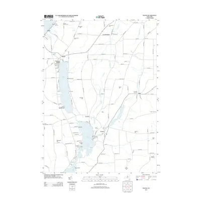
2013 Map of Wayne
USGS Topo · Published 2013About this map
Keuka Lake and its finger-lake counterparts define this rural stretch of New York, where the upland vineyards of McGregor Vineyard Winery and Keuka Overlook Cellars overlook the water. The landscape is marked by a series of narrow north-south valleys containing Waneta Lake and Lamoka Lake, separated by prominent ridges such as Stocking Hill and House Hill. Small crossroads communities like Tyrone, Altay, and Weston serve as local hubs, maintaining deep historical ties through sites like Tyrone Union Cem and the Altay Baptist Church Cem.
Find a feature on this map
137 named features on this map. Tap any name to fly to it.
Don’t see what you’re looking for? This feature index may not catch every label — zoom into the map to look around manually.
Map Details
Editions of this 2013 Wayne Map
This is the sole edition of this map. No revisions or reprints were ever made.
Other maps of this area

1898 · Watkins Glen
USGS Topo · 1:62,500

1901 · Watkins
USGS Topo · 1:62,500

1902 · Ovid
USGS Topo · 1:62,500

1903 · Penn Yan
USGS Topo · 1:62,500

1903 · Hammondsport
USGS Topo · 1:62,500

1905 · Watkins Glen
USGS Topo · 1:125,000

1942 · Pulteney
USGS Topo · 1:31,680

1942 · Dundee
USGS Topo · 1:24,000

1942 · Keuka Park
USGS Topo · 1:24,000

1943 · Keuka Lake
USGS Topo · 1:31,680