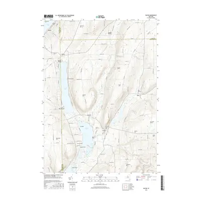
2016 Map of Wayne
USGS Topo · Published 2016About this map
Waneta Lake and Lamoka Lake form a distinctive north-south corridor of water that defines the local geography where Steuben, Schuyler, and Yates Counties converge. The settlement of Wayne anchors the northern end of this corridor, while Tyrone and Weston occupy the narrowing land bridge between the two major lakes. This mid-2010s survey illustrates a landscape primarily composed of high ridges and narrow valleys, with many landmarks bearing family names such as Barrington Hill, Sebring Hill, and Whitehead Hill. Genealogists will find several historic burial grounds, including the McDowell Cem near the western shore and the Altay Baptist Church Cem to the east. Modern recreation is represented by the N Country National Scenic Trail winding through the southeastern hills, while the shoreline of Keuka Lake clips the northwestern corner at Kendall Point.
Find a feature on this map
104 named features on this map. Tap any name to fly to it.
Don’t see what you’re looking for? This feature index may not catch every label — zoom into the map to look around manually.
Map Details
Editions of this 2016 Wayne Map
This is the sole edition of this map. No revisions or reprints were ever made.
Other maps of this area

1898 · Watkins Glen
USGS Topo · 1:62,500

1901 · Watkins
USGS Topo · 1:62,500

1902 · Ovid
USGS Topo · 1:62,500

1903 · Penn Yan
USGS Topo · 1:62,500

1903 · Hammondsport
USGS Topo · 1:62,500

1905 · Watkins Glen
USGS Topo · 1:125,000

1942 · Pulteney
USGS Topo · 1:31,680

1942 · Dundee
USGS Topo · 1:24,000

1942 · Keuka Park
USGS Topo · 1:24,000

1943 · Keuka Lake
USGS Topo · 1:31,680