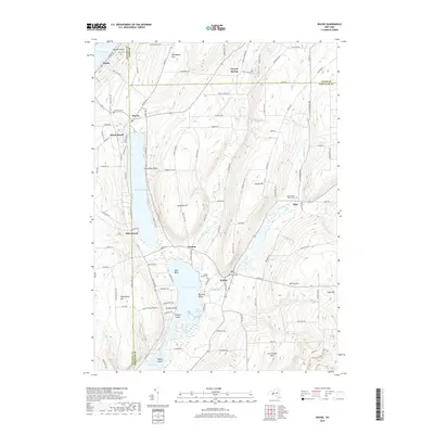
2019 Map of Wayne
USGS Topo · Published 2019About this map
Waneta Lake and Lamoka Lake sit at the center of this Finger Lakes region landscape, where the border of Steuben, Yates, and Schuyler counties converge. The settlement of Wayne serves as a northern anchor near the tip of Keuka Lake, while the village of Tyrone and the smaller hamlet of Weston occupy the narrow land between the two central lakes. The terrain is marked by distinct promontories like Swarthout Point and Barnards Point, reflecting a topography carved by glacial movement.
Find a feature on this map
114 named features on this map. Tap any name to fly to it.
Don’t see what you’re looking for? This feature index may not catch every label — zoom into the map to look around manually.
Map Details
Editions of this 2019 Wayne Map
This is the sole edition of this map. No revisions or reprints were ever made.
Other maps of this area

1898 · Watkins Glen
USGS Topo · 1:62,500

1901 · Watkins
USGS Topo · 1:62,500

1902 · Ovid
USGS Topo · 1:62,500

1903 · Penn Yan
USGS Topo · 1:62,500

1903 · Hammondsport
USGS Topo · 1:62,500

1905 · Watkins Glen
USGS Topo · 1:125,000

1942 · Pulteney
USGS Topo · 1:31,680

1942 · Dundee
USGS Topo · 1:24,000

1942 · Keuka Park
USGS Topo · 1:24,000

1943 · Keuka Lake
USGS Topo · 1:31,680