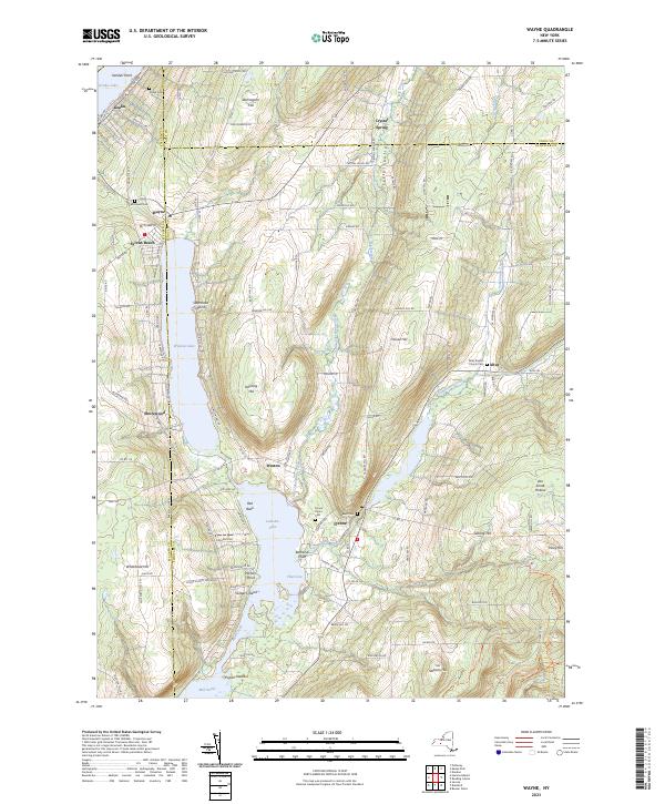
2023 Map of Wayne
USGS Topo · Published 2023About this map
Keuka Lake and the interconnected waters of Waneta Lake and Lamoka Lake define this pocket of the Finger Lakes region, spanning the borders of Steuben, Yates, and Schuyler counties. The landscape is marked by steep ridges such as Barrington Hill and Stocking Hill, with the lower elevations supporting settlements like Wayne, Tyrone, and Weston. Numerous small family and community burial grounds, including the McDowell Cem and Tyrone Union Cem, are scattered across the terrain, reflecting the long-standing agricultural and rural settlement patterns of the area.
Find a feature on this map
77 named features on this map. Tap any name to fly to it.
Don’t see what you’re looking for? This feature index may not catch every label — zoom into the map to look around manually.
Map Details
Editions of this 2023 Wayne Map
This is the sole edition of this map. No revisions or reprints were ever made.
Other maps of this area

1898 · Watkins Glen
USGS Topo · 1:62,500

1901 · Watkins
USGS Topo · 1:62,500

1902 · Ovid
USGS Topo · 1:62,500

1903 · Penn Yan
USGS Topo · 1:62,500

1903 · Hammondsport
USGS Topo · 1:62,500

1905 · Watkins Glen
USGS Topo · 1:125,000

1942 · Pulteney
USGS Topo · 1:31,680

1942 · Dundee
USGS Topo · 1:24,000

1942 · Keuka Park
USGS Topo · 1:24,000

1943 · Keuka Lake
USGS Topo · 1:31,680