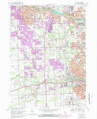
1948 Map of Wayne
USGS Topo · Published 1948About this map
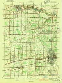
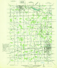
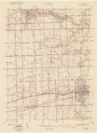
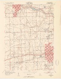
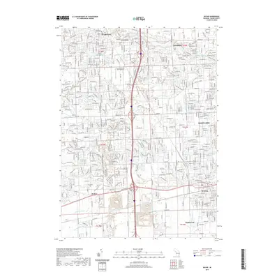
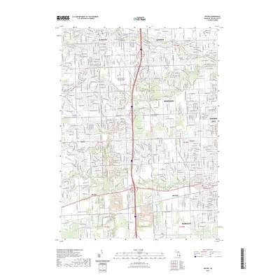
The Pere Marquette railroad network serves as the industrial spine for this corridor between Plymouth and Wayne in the early 1940s. While Plymouth and Wayne show concentrated residential and commercial blocks, the surrounding townships of Plymouth, Canton, and Nankin remain largely defined by an intricate drainage system including the Lower River Rouge and Fellows Creek. This landscape is caught at a moment of transition, where aviation sites like Triangle Airport and established community centers like Newburg and Sheldon sit alongside a dense network of country schools, such as Bartlett Sch and Walker Sch. Local history is anchored by several burial grounds, notably Riverside Cemetery and Cadillac Memorial Park Cem, which provide fixed genealogical reference points as the suburban expansion of Detroit begins to push westward along Michigan Ave and the Ann Arbor Rd.
Find a feature on this map
74 named features on this map. Tap any name to fly to it.
Don’t see what you’re looking for? This feature index may not catch every label — zoom into the map to look around manually.
Map Details
Editions of this 1948 Wayne Map
This is the sole edition of this map. No revisions or reprints were ever made.
Historical Maps of Canton Township Through Time
11 maps found

Featured Locations
- Canton Township, MI
- Livonia, MI
- Van Buren Charter Township, MI
- Westland, MI
- Canton Charter Township, Canton Township