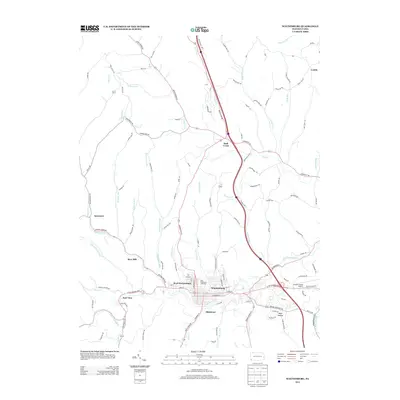
2013 Map of Waynesburg
USGS Topo · Published 2013About this map
Waynesburg and its surrounding communities in Greene County are defined by a dense network of runs and creeks that have shaped the region's topography and development. This 2013 survey illustrates the modern footprint of the county seat, showing how residential and commercial corridors follow the path of S Fork Tenmile Cr and its many tributaries, such as Purman Run and Smith Cr. Small peripheral settlements like Blairtown, East View, and West Waynesburg appear as extensions of the central borough, while more outlying locales such as Ruff Creek and Sycamore maintain their distinct rural identities. The landscape is also marked by significant landmarks like the Greene County Airport and the Carl D Johnson Commons, reflecting the area's role as a regional hub. Local history is etched into the roads, where names like Toll Gate Run and WW Railroad Rd hint at the historical transportation routes that preceded modern highways.
Find a feature on this map
126 named features on this map. Tap any name to fly to it.
Don’t see what you’re looking for? This feature index may not catch every label — zoom into the map to look around manually.
Map Details
Editions of this 2013 Waynesburg Map
This is the sole edition of this map. No revisions or reprints were ever made.
Other maps of this area

1901 · Amity
USGS Topo · 1:62,500

1901 · Waynesburg
USGS Topo · 1:62,500

1904 · Amity
USGS Topo · 1:62,500

1904 · Waynesburg
USGS Topo · 1:62,500

1905 · Rogersville
USGS Topo · 1:62,500

1907 · Claysville
USGS Topo · 1:62,500

1949 · Clarksburg
USGS Topo · 1:250,000

1951 · Canton
USGS Topo · 1:250,000

1953 · Canton
USGS Topo · 1:250,000
1954 · Ellsworth
USGS Topo · 1:24,000