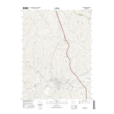
2016 Map of Waynesburg
USGS Topo · Published 2016About this map
The South Fork Tenmile Creek basin defines the layout of the Greene County seat and its surrounding borough-extensions in this 2016 survey. The central hub of Waynesburg is bordered by the industrial and residential pockets of Blairtown, Morrisville, and West Waynesburg, with Waynesburg Univ anchored in the heart of the community. Higher elevations surrounding the creek valley are dotted with family and community burial grounds, including Oakmont Cem and Green Mount Cem.
Find a feature on this map
108 named features on this map. Tap any name to fly to it.
Don’t see what you’re looking for? This feature index may not catch every label — zoom into the map to look around manually.
Map Details
Editions of this 2016 Waynesburg Map
This is the sole edition of this map. No revisions or reprints were ever made.
Other maps of this area

1901 · Amity
USGS Topo · 1:62,500

1901 · Waynesburg
USGS Topo · 1:62,500

1904 · Amity
USGS Topo · 1:62,500

1904 · Waynesburg
USGS Topo · 1:62,500

1905 · Rogersville
USGS Topo · 1:62,500

1907 · Claysville
USGS Topo · 1:62,500

1949 · Clarksburg
USGS Topo · 1:250,000

1951 · Canton
USGS Topo · 1:250,000

1953 · Canton
USGS Topo · 1:250,000
1954 · Ellsworth
USGS Topo · 1:24,000