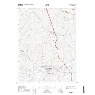
2019 Map of Waynesburg
USGS Topo · Published 2019About this map
The borough of Waynesburg serves as a central hub on this Greene County landscape, where the historic Greene County Courthouse and the campus of Waynesburg University anchor the street grid. The surrounding area is defined by a dense network of valleys carved by South Fork Tenmile Creek and its many tributaries, including Purman Run and Browns Creek. The terrain is marked by distinctive named hollows like Dark Hollow and Brickyard Hollow, illustrating the deeply dissected topography of the region.
Find a feature on this map
124 named features on this map. Tap any name to fly to it.
Don’t see what you’re looking for? This feature index may not catch every label — zoom into the map to look around manually.
Map Details
Editions of this 2019 Waynesburg Map
This is the sole edition of this map. No revisions or reprints were ever made.
Other maps of this area

1901 · Amity
USGS Topo · 1:62,500

1901 · Waynesburg
USGS Topo · 1:62,500

1904 · Amity
USGS Topo · 1:62,500

1904 · Waynesburg
USGS Topo · 1:62,500

1905 · Rogersville
USGS Topo · 1:62,500

1907 · Claysville
USGS Topo · 1:62,500

1949 · Clarksburg
USGS Topo · 1:250,000

1951 · Canton
USGS Topo · 1:250,000

1953 · Canton
USGS Topo · 1:250,000
1954 · Ellsworth
USGS Topo · 1:24,000