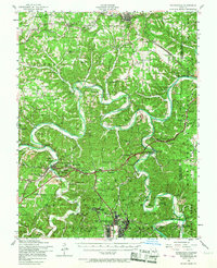
1954 Map of Waynesville
USGS Topo · Published 1967About this map
Fort Leonard Wood and its expansive military reservation dominate the southern half of this mid-century survey, showcasing a period of significant federal presence in the Ozarks. North of the base, the landscape is defined by the winding Gasconade River and Big Piney River, where local life is mapped through a dense network of family cemeteries and rural schoolhouses like Hamilton School and Needmore School. The mapping of a Dismantled railroad alongside the active St Louis - San Francisco Railroad near Dixon and Franks points to the area's evolving transportation history.
Find a feature on this map
108 named features on this map. Tap any name to fly to it.
Don’t see what you’re looking for? This feature index may not catch every label — zoom into the map to look around manually.
Map Details
Editions of this 1954 Waynesville Map
2 editions found
Other maps of this area

1888 · Tuscumbia
USGS Topo · 1:125,000

1894 · Tuscumbia
USGS Topo · 1:125,000

1912 · Rolla
USGS Topo · 1:62,500

1933 · Iberia
USGS Topo · 1:62,500

1936 · Waynesville
USGS Topo · 1:48,000

1937 · Iberia
USGS Topo · 1:62,500

1937 · Edgar Springs
USGS Topo · 1:48,000

1937 · Vienna
USGS Topo · 1:62,500

1938 · Vienna
USGS Topo · 1:48,000

1941 · Big Piney
USGS Topo · 1:62,500