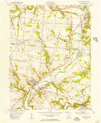
1955 Map of Waynesville
USGS Topo · Published 1956About this map
The Little Miami River corridor serves as the primary geographical axis for this mid-century survey, dividing the landscape between the Great Miami River Base to the west and the Virginia Military District to the east. The village of Waynesville anchors the southwest, mirrored across the water by Corwin, where the Pennsylvania RR follows the riverbank. This rail link connects a string of rural communities including Roxanna, Spring Valley, and the former settlement at Mount Holly. Historically significant sites like Sugar Creek Ch, Middle Run Ch, and the large Miami Cemetery are clearly marked, providing essential data for genealogical research. The topography rises toward Harveysburg Hill in the southeast, overlooking Harveysburg and the winding course of Caesar Creek before its eventual impoundment in later decades.
Find a feature on this map
56 named features on this map. Tap any name to fly to it.
Don’t see what you’re looking for? This feature index may not catch every label — zoom into the map to look around manually.
Map Details
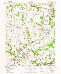
Editions of this 1955 Waynesville Map
2 editions found
Other maps of this area

1907 · Blanchester
USGS Topo · 1:62,500

1913 · Waynesville
USGS Topo · 1:62,500

1914 · Morrow
USGS Topo · 1:62,500

1915 · Waynesville
USGS Topo · 1:62,500

1916 · Morrow
USGS Topo · 1:62,500

1917 · Xenia
USGS Topo · 1:62,500

1947 · Columbus
USGS Topo · 1:250,000

1953 · Cincinnati
USGS Topo · 1:250,000

1955 · New Burlington
USGS Topo · 1:24,000
1955 · Lebanon
USGS Topo · 1:24,000