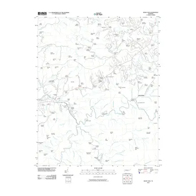
2010 Map of Wear Cove
USGS Topo · Published 2010About this map
Walker Fields and the surrounding mountain ridges define this 2010 landscape in Blount County, where the Little River and its numerous forks carve through the terrain. The map captures a detailed view of the regional topography, from the heights of Fodderstack Mountain and High Top to the low-lying Walker Valley. This area is dense with local heritage, marked by a high concentration of burial grounds including Headrick Chapel Cemetery, Brickey Cemetery, and Little Greenbrier Cemetery.
Find a feature on this map
192 named features on this map. Tap any name to fly to it.
Don’t see what you’re looking for? This feature index may not catch every label — zoom into the map to look around manually.
Map Details
Editions of this 2010 Wear Cove Map
This is the sole edition of this map. No revisions or reprints were ever made.
Other maps of this area

1886 · Knoxville
USGS Topo · 1:125,000

1892 · Knoxville
USGS Topo · 1:125,000

1894 · Knoxville
USGS Topo · 1:125,000

1895 · Knoxville
USGS Topo · 1:125,000

1901 · Knoxville
USGS Topo · 1:125,000

1935 · Knoxville
USGS Topo · 1:48,000

1935 · Walden Creek
USGS Topo · 1:24,000

1935 · Wildwood
USGS Topo · 1:24,000

1935 · Sevierville
USGS Topo · 1:48,000
1935 · Pigeon Forge
USGS Topo · 1:24,000