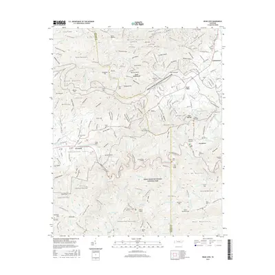
2016 Map of Wear Cove
USGS Topo · Published 2016About this map
Tuckaleechee Cove and the town of Townsend serve as the western gateway to the high ridgelines of the Great Smoky Mountains National Park. This terrain is defined by its deep hollows and family-named cemeteries, including Hatcher Cem, Mattox Cem, and the Sallie Moore Cem near Greenbrier. The landscape transitions from the agricultural valley floors of Wear Valley to the dramatic heights of Fodderstack Mountain and Meigs Mountain.
Find a feature on this map
241 named features on this map. Tap any name to fly to it.
Don’t see what you’re looking for? This feature index may not catch every label — zoom into the map to look around manually.
Map Details
Editions of this 2016 Wear Cove Map
This is the sole edition of this map. No revisions or reprints were ever made.
Other maps of this area

1886 · Knoxville
USGS Topo · 1:125,000

1892 · Knoxville
USGS Topo · 1:125,000

1894 · Knoxville
USGS Topo · 1:125,000

1895 · Knoxville
USGS Topo · 1:125,000

1901 · Knoxville
USGS Topo · 1:125,000

1935 · Knoxville
USGS Topo · 1:48,000

1935 · Walden Creek
USGS Topo · 1:24,000

1935 · Wildwood
USGS Topo · 1:24,000

1935 · Sevierville
USGS Topo · 1:48,000
1935 · Pigeon Forge
USGS Topo · 1:24,000