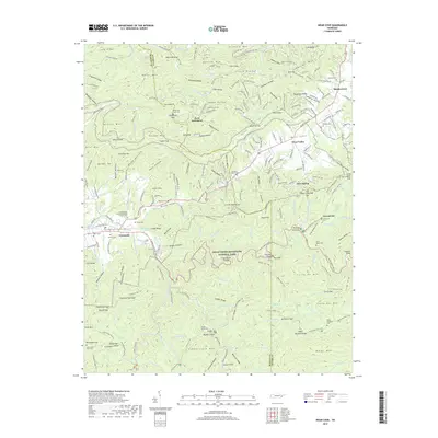
2019 Map of Wear Cove
USGS Topo · Published 2019About this map
Great Smoky Mountains National Park dominates the southern half of this landscape, where the Little River carves through deep gaps and over landmarks like The Sinks. The boundary between Blount and Sevier counties runs through the heart of Wear Valley, a broad cove that has long served as a corridor for settlement beneath the peaks of Benson Mtn and Little Rocky. The map captures a transition from the agricultural lowlands of Tuckaleechee Cove near Townsend to the high mountain ridges of Lumber Ridge and Meigs Mtn.
Find a feature on this map
257 named features on this map. Tap any name to fly to it.
Don’t see what you’re looking for? This feature index may not catch every label — zoom into the map to look around manually.
Map Details
Editions of this 2019 Wear Cove Map
This is the sole edition of this map. No revisions or reprints were ever made.
Other maps of this area

1886 · Knoxville
USGS Topo · 1:125,000

1892 · Knoxville
USGS Topo · 1:125,000

1894 · Knoxville
USGS Topo · 1:125,000

1895 · Knoxville
USGS Topo · 1:125,000

1901 · Knoxville
USGS Topo · 1:125,000

1935 · Knoxville
USGS Topo · 1:48,000

1935 · Walden Creek
USGS Topo · 1:24,000

1935 · Wildwood
USGS Topo · 1:24,000

1935 · Sevierville
USGS Topo · 1:48,000
1935 · Pigeon Forge
USGS Topo · 1:24,000