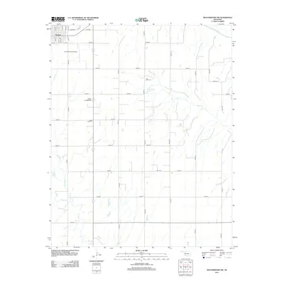
2012 Map of Weatherford NW
USGS Topo · Published 2012About this map
Thomas occupies the northwestern corner of this landscape, its grid of streets like N Main St and E Kansas St giving way to a vast network of section-line roads. The terrain is defined by the drainage of the Canadian River in the north and the sprawling basins of Deer Cr and Bear Cr to the south. Distinctive landmarks such as Sugar Loaf Mound rise above the plains, providing natural orientation points amidst the agricultural plots.
Find a feature on this map
40 named features on this map. Tap any name to fly to it.
Don’t see what you’re looking for? This feature index may not catch every label — zoom into the map to look around manually.
Map Details
Editions of this 2012 Weatherford NW Map
This is the sole edition of this map. No revisions or reprints were ever made.
Other maps of this area

1955 · Clinton
USGS Topo · 1:250,000

1957 · Clinton
USGS Topo · 1:250,000

1957 · Clinton
USGS Topo · 1:62,500

1962 · Putnam
USGS Topo · 1:62,500

1964 · Oakwood
USGS Topo · 1:62,500

1964 · Weatherford
USGS Topo · 1:62,500

1976 · Clinton SE
USGS Topo · 1:24,000

1976 · Clinton NE
USGS Topo · 1:24,000
1983 · Indianapolis
USGS Topo · 1:24,000
1983 · Clinton NE
USGS Topo · 1:24,000